
By Susan Bromley 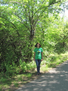
Staff Writer
Brandon Twp.-Glaciers and trails wouldn’t seem to have much in common other than both are found in nature.
The former is created without human intervention in areas of the world where snow is a constant and turns to ice in a process that commonly takes up to 100 years.
Although trails don’t typically exist in a climate that is literally as constantly cold as what is required for glaciers, trails can also take decades to form when given a chilly reception by the humans whose help 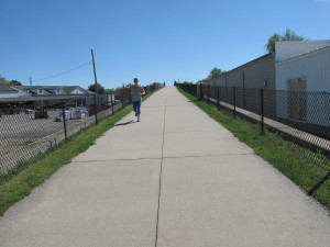 is required to bring them to fruition.. Such may be the case with segments of the Iron Belle Trail, which has been proposed to run through the township and the Village of Ortonville, but which is currently stalled after officials in both communities removed proposed routes from consideration due to opposition.
“These trails sometimes work at glacial paces,” said Kristen Bennett, Iron Belle Trail coordinator for the Michigan Department of Natural Resources. “We’re going to continue to talk to Brandon Township and the village. We are still hopeful. At some point, if the communities continue to be resistant, we will have to look at alternative routes, but we are not there yet.”
The township board is set to discuss the future of the Iron Belle Trail in the community at their next meeting, set for 7 p.m., June 5, at the township offices, 395 Mill St.
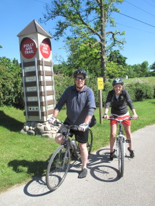
The Iron Belle Trail is a state project which seeks to establish a continuous trail from Belle Isle in Detroit to Ironwood in the Upper Peninsula, with two separate routes, one for hiking and one for biking. The routes were carefully chosen to utilize existing trails in the state to which new trails could connect and be the safest for trail users and the environment and least expensive for communities. The biking trail is proposed to traverse 791 miles, includes the Polly Ann Trail in Oxford and Orion, and would establish new trails in Brandon, Groveland, and Atlas townships, as well as the Village of Ortonville.
Last year, Brandon Township officials conducted a trail survey about four potential routes in the community to which 558 people responded, with 40 percent expressing support for Route C, a 7.7 mile route using the ITC corridor, which had an estimated construction cost of $4,968,900, the safest and least expensive of the four routes. Last month, however, the board passed a resolution removing the route from consideration. The resolution was drafted and brought to the board by Trustee Scott Broughton, who lives along the proposed route. Broughton was joined by Clerk Candee Allen, Treasurer Terri Darnall, and Trustee Bob Marshall in passing the resolution. Thurman and Trustees Dana DePalma and Kris Kordella voted no on removing the route.
At Monday’s meeting, Thurman said the board would discuss other proposed routes for the Iron Belle Trail which include Route A, which is 7.6 miles from Baldwin to Sherwood to Sashabaw to Hummer Lake to Mill Street, estimated to cost $5,851,400.00; Route B, which is Seymour Lake to the ITC corridor to Granger to Hadley to Hummer Lake to Mill for 9.7 miles and costs $7,918,510; and Route D, from Baldwin to Granger to Hadley to Hummer Lake to Mill Street and stretches 8 miles for $8,127,205. The board may also discuss the non-survey option of placing the Iron Belle Trail in the township alongside Seymour Lake Road and M-15.
In the past month, Thurman has received feedback from residents that are now requesting other routes be removed from consideration.
Thurman said a resolution is a more serious administrative decision and while she doesn’t think this board would reverse the decision, if the members of the board change, the route might be reconsidered. For now, she believes the board needs to discuss the repercussions of that decision and how they want to proceed.
“It seems as though people think we don’t want to proceed with a trail segment,” she said. “I would like the board to make a statement as to what route they would like to pursue if they want to pursue a route. My opinion is having a segment of the Iron Belle Trail through Brandon Township would greatly benefit our residents and I would be in favor of any route.”
The Ortonville Village Council also recently took a piece of property that could have been used to develop the Iron Belle Trail in the village out of the mix.
At their April 24 meeting, the council passed by a 4-2 vote a motion to designate a 47-acre parcel of land as a wildlife preservation park on which use of off-road vehicles, motor bikes, hunting, and development of bike or foot path or trails is prohibited, as well as “any other use other than to preserve, support and protect the habitat and wildlife on this property.”
The property, located west of the Crescent Hill subdivision, was deeded to the village in 1982 for park or recreational use, and Village Manager David Trent had proposed earlier in the year its possible use for a connection to the Iron Belle Trail.
Councilmember Dan Eschmann introduced the motion which eliminated that possibility for the property, and was supported by council members Coleen Skornicka, Karen Sleva, and Mark Butzu. Council President Wayne Wills and Councilmember Tonja Brice voted no on the motion. Councilmember Keith Dylus was absent.
The resistance to the trail in the township and village is holding up progress on the project in Oxford, the township’s neighbor to the east, which has requested grant funding from the DNR for the Iron Belle Trail.
“Brandon taking things off the table is causing problems with Oxford and Oxford Township,” said Bennett. “They have requested funding from us for some of the trail and we haven’t been able to give it because we have to make sure the next piece of the trail is solidified.”
In Oxford, part of the Iron Belle Trail is already established in the Polly Ann Trail. Oxford and the state of Michigan want to continue the Iron Belle Trail’s route by putting new trail alongside Seymour Lake Road (starting at where it is still Burdick Road) in the right of way, west to N. Baldwin Road where it meets the Brandon Township border.
Resistance in Brandon Township will not stop their neighbor to the north from moving forward with trail progress. In March, the DNR awarded a $25,000 grant to the Michigan Department of Transportation for the purpose of scoping and preliminary construction and engineering cost estimates to place 3 miles of the Iron Belle Trail alongside the M-15 corridor in Atlas Township from Hegel Road to County Line Road.
“The goal is that the trail would be a separated use path, not connected to M-15,” said Jacob Maurer, Genesee County Metro Planning Commission planner II. “The space between the path and M-15 would vary, there are wetlands and bridges to take into account. I think it’s a great start for bringing new users into our rural communities and connecting the two counties.”
In Genesee County, the Iron Belle Trail is proposed to cover 43 miles from Atlas Township to Grand Blanc, through Burton, Flint, and up into Genesee and Richfield Township, along Mott Lake and the Flint River, ultimately connecting to the Southern Links Trail in Columbiaville.
Half of the project is already existing in Genesee County and 8 miles of new trail is currently funded. Funding to scope the entire route has already been secured.
Atlas Township was not affected for funding, because regardless of whether Brandon Township connects, the project will utilize the M-15 corridor.
“They are not held up because we know (the trail) will eventually get to M-15 and head north,” said Bennett. “The plan on that I believe is to consistently widen the shoulders up M-15 so that it is an 8-10 foot shoulder. The trail would be on the widened road shoulder—a white line, then 5 to10 feet of pavement outside instead of a 1-foot bike lane.”
Bennett notes that the biking portion of the Iron Belle Trail will vary in width and environment all along the proposed 700-plus mile route. Some areas will be naturally safer and more scenic in rural locations, and some portions will have heavy traffic. For example, she said MDOT approved funding for the City of Warren in Macomb County to put in bike lanes along Van Dyke or Dequindre for the trail. But now that the trail is in place in that city, there are safety concerns. Bennett suggests that perhaps the solution to that concern is educating citizens on the new infrastructure they have, but currently don’t know how to use.
“As we are building a huge, statewide trail, remember that just because you put it on the ground doesn’t mean that people know how to deal with it,” she said.
In Brandon Township, Route C, using the ITC corridor easements, was also the safest route, going off road. Residents on the route objected, however, citing concerns about privacy and crime and costs.
Maintenance of a trail is expensive, said Linda Moran, who manages the Polly Ann Trail for the Polly Ann Trail Management Council, a non-profit organization.
“You can’t downplay or sugarcoat it— it’s shocking to me how much money it costs to run the trail,” said Moran. “You have to have a lot of people understand that before going in. Do it, but be aware.”
On average, she said it costs about $50,000 annually to maintain the 14.2 mile long Polly Ann Trail. Each community along the trail, which includes Orion, Oxford, Addison and Leonard townships, pays a stipend for maintenance of the trail, and there are also donations of in-kind services and fundraisers.
Maintenance costs include equipment expenditures, mowing, removal of trash, and repairs, including repainting bridges and fixing rails damaged by vandalism, about which she is very matter-of-fact.
“There is vandalism frequently,” she said. “This is just day-to-day business. You paint over the graffiti, pick up the garbage and move on. You have to be aware of the costs of doing business. You can’t put a trail in for $7 million and say, ‘We got this trail, isn’t it fabulous?’ and then never do anything else. It’s like a newborn baby, you have to take care of it or it will die.”
Moran speaks honestly about the pitfalls, but she is just as quick to say that the positives outweigh the negatives.
“Being part of the trail system day to day is a lot of work, but you get a lot of people involved in the community— exercising, enjoying the beauty of nature and see what is going on in the community…You see swans and their babies, turtles that are endangered. You see that stuff, and it makes you think, ‘This is us— this is how we want to represent ourselves.’ It’s worth the effort… It’s expensive and a tough sell, because people don’t want to spend money on dirt. If the DNR is going to give you $7 million to make it, take the $7 million and make it, but you aren’t going to run it for free.”
At the June 5 township board meeting, the Iron Belle Trail will be discussed again. Whether officials will take the road less traveled and move forward with a connection to the trail remains to be seen.
“Having a regional trail in the area is not supposed to be a burden, it’s something you are supposed to feel excited about,” said Bennett. “If we get the feeling this is not wanted, we will go elsewhere. We want to go through the community because we think it’s a great community, but they have to want it… Until a community says don’t come through— with a definite loud no— we include those miles on the trail route.”
If the answer is ultimately no in Brandon, Bennett said alternate routes from downtown Oxford to Goodrich would be examined, possibly including the Ortonville Recreation Area, most of which is in Metamora, and which would not be easy to develop, considering the amount of wetlands and the park’s general topography.
“There is not a lot of road cutting through that park, it would take a whole lot to figure out how to get through there,” she said. “We’re talking about a 10-foot wide paved or crushed limestone trail, there’s a lot more impact to the environment… In plotting the Iron Belle Trail, we wanted to utilize trails in existence and use areas with scenic views, but with limited environmental impact. Ortonville fits that view.”
Bennett continues to be optimistic that Brandon Township and the Village of Ortonville will join in the vision for the Iron Belle Trail.
“Although we want the trail completed in a 5-10 year timeframe, we know not every community can meet that, and we will fill gaps into the future even farther than that. The trail community is very, very patient. It is done in glacial ages, it’s not going to happen tomorrow.”
Iron BelleTrail future eyed added by Susan Bromley on
View all posts by Susan Bromley →